Flight Plan with Dronelink "Growth"
Hello
I need help with the flight plan for a perfect 3D model of these 4 houses. I have Dronelink “Growth”.
The houses are approx. 15m high.
At what altitude should the Nidar (MAP) flight take place?
How should the orbits (circles) be planned with a distance to the building?
How many orbits with which gimbal tilts?
Is Facade Mission necessary?
Do I still have to take a flight between nearby houses?
Can someone plan the optimal flight for me as an example?
I would be so grateful to have an optimal template.
Address: Muelligerstrasse 2, 5413 Birmenstorf, Switzerland
Thanks alot. Greetings from Switzerland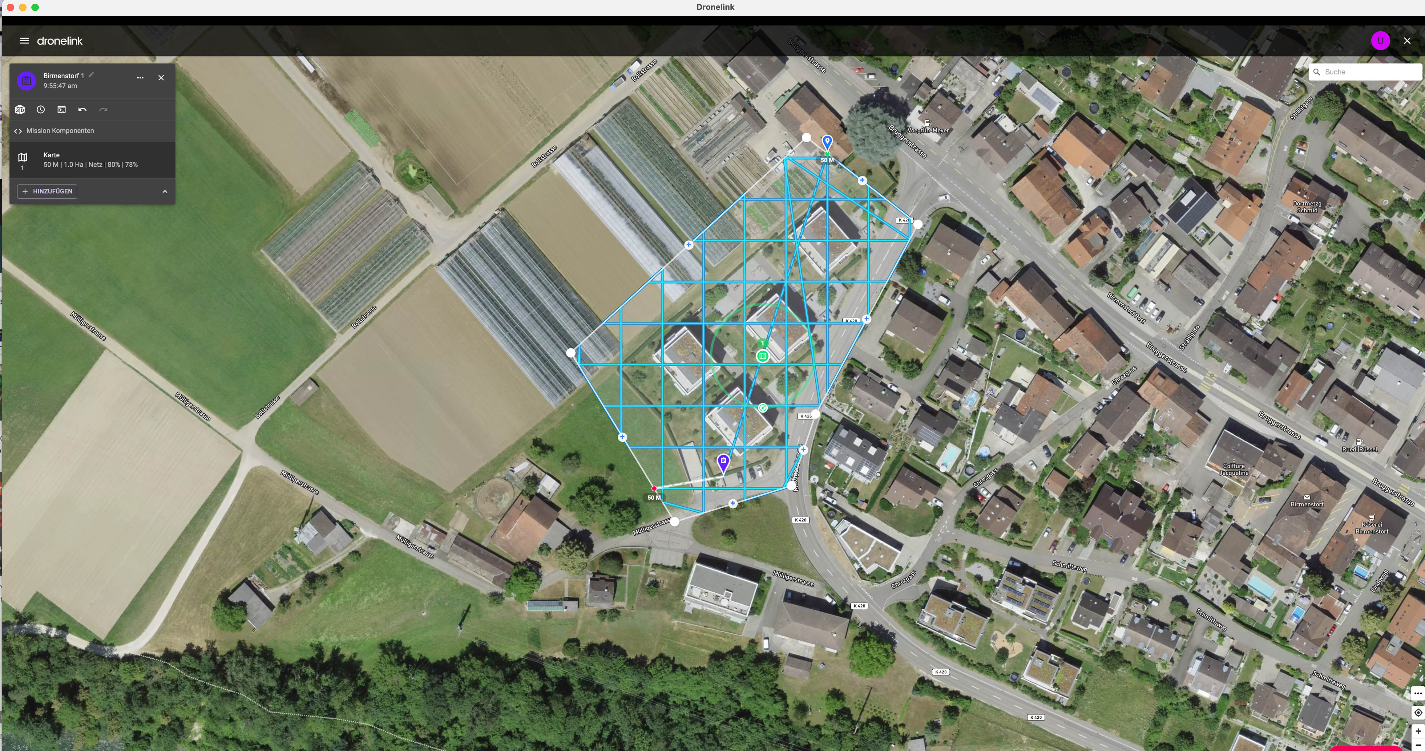
Comments
3 comments
I suggest you give this video by Barry Houldsworth a watch, as there's more to 3D modelling than just taking the photos
https://www.youtube.com/watch?v=nrw-3RLABkM
Thanks Martin Reading
And U Streuli - depending on what you are trying to do you might also want to check out this video. https://youtu.be/F0Xtwa3YObI
You're welcome Barry, Might check out the Gausian blurring one again myself
Please sign in to leave a comment.