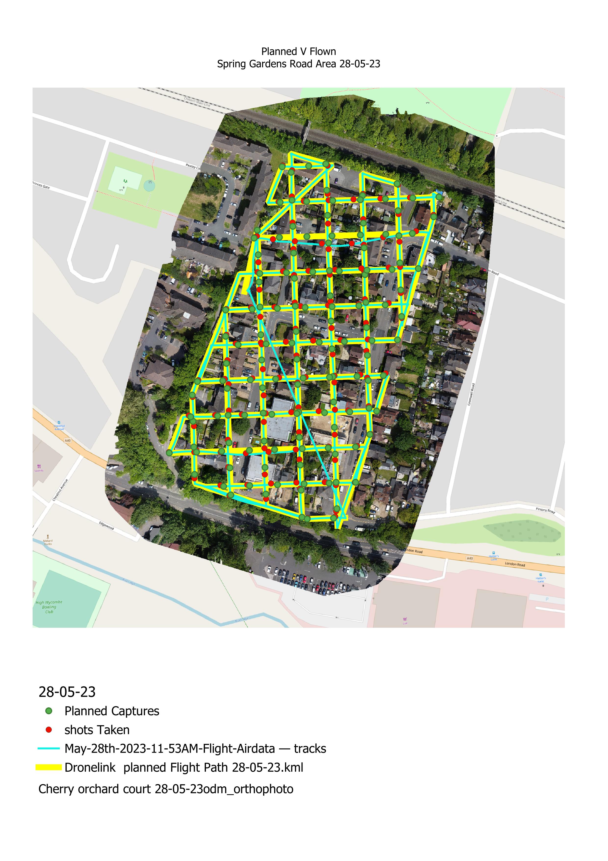
Ever wondered how close a flown mission is to what was planned
As the title says, have you ever wondered how close a flown mission is to what you had planned, including on mapping missions, the planned location of photos, compared to where they were actually taken, well by combining data from Dronelink, Google Earth, WebODM, and Airdata UAV in QGIS, this is actually possible as can be seen in the picture below (video coming soon)
Comments
1 comment
Pretty interesting. Good work!
I suspect add ingredients an RTK module would improve accuracy greatly. A good experiment if anyone in the community has one on their drone.
Now Martin, do you think the offset distances are the result of GPS inaccuracies or more likely latencies between when the camera was planned to go off vs when it actually did go off? It's a little hard to tell what the flight direction was on the grid so should we assume the nearest red dot ro green dot represents the planned vs actual photo location?
Can you quantify the RMS error distance between planned and actual photos?
Jim - could the RMS average distance be included in the flight summary? This would be a simple single value distance on the overall flight accuracy. A nice thing to know!
Please sign in to leave a comment.