Waypoint altitude references
Hi there,
Currently I am using WEP app 4.1.0 Kernel 4.1.0. In the current version I can choose between 2 references: Takeoff Location and Ground Level. I remember that there used to be a third reference point: the height above sea level. Has this option been removed or am I just can't find it? In the past, I used to use this in very hilly areas near the sea, when I could not accurately guarantee the height of the take-off point.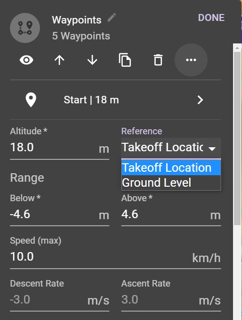
Comments
4 comments
I believe it was removed. Never used It myself and AGL works so well I didn’t need it.
Hi Mike, if you are in such place as Santorini (Greece) where the map in WEB app is not enough detailed (and also you do not know the place) and the environment is very hilly and you can not precisely define the take off point you can have even 20 m of height difference between the planned take off point height and the reality. In such situation I used the Takeoff reference as sea level. After planning I always checked my plan in Google maps and never encountered any problem...
Hi Gábor Bokrossy, in that type of situation and using AGL, I'd open the editor while on site and move the take off location to my location
I understand your situation. Maybe you should post a feature request and see what Jim says. I’m guessing they removed it for a reason. I use AGL a good amount of the time since I live in a hilly area out in the country. Once you place the reference pin if will calculate the correct AGL for the terrain. If I need to move the take-off area I adjust as Martin stated and no issues. Good luck. Enjoy…..
Please sign in to leave a comment.