Exported kmz includes odd styling for 4 and 21; how's come?
Thank you for being able to export a .kmz file of the flightpath from Dronelink. It's great for loading into GIS and mapping softwares.
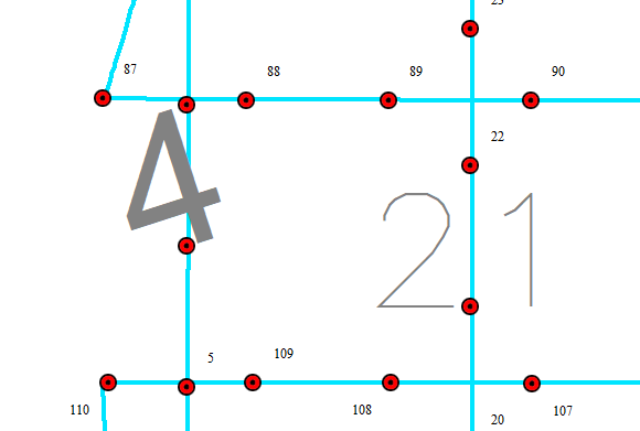
There's a curious bit which all exports share, and while it seems benign, it remains nonetheless puzzling. The odd styling for these two numbers; 4 and 21 (which appear to be sequential capture numbers), aren't revealed when the .kmz gets opened in Google Earth Pro, but they appear as shown below every time when the .kmz is loaded into a Global Mapper workspace. Any idea why? Edit: See answer below.
Thank you very much!
Kind regards,
Kelly
Comments
1 comment
Well, it looks like that the issue is due to the odd styling that's being imposed on only these 2 point features. In the case of the 4th capture point feature, the odd styling looks like this:
Noting that there are numerous odd style settings as compared with the typical styling for the capture point features:
Hope this helps to fix this minor bug.
Please sign in to leave a comment.