Marking spots on the ground
Good day
I hope this email finds you well. I have a drone application that I want to find out if your application can do this. I know that you have a waypoint feature where the drone can hover over the specific waypoint.
The process that I want to follow is as follows:
1. Using survey tools or a drone, I identify an area.

2. With software (AutoCAD or similar) I create field boundaries and equal distance points to mark.
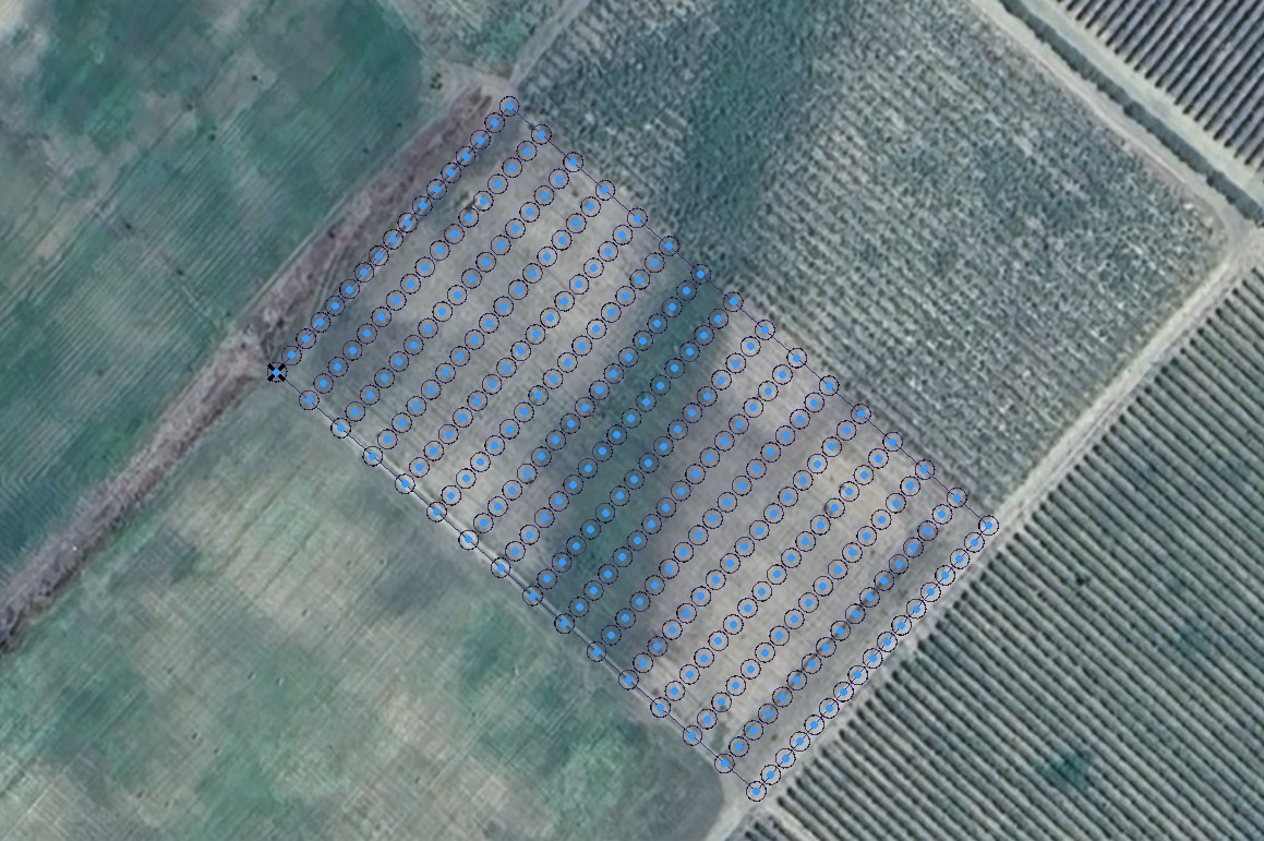
3. The drone must then fly to each point (1cm accuracy), hover at <1m and mark it with spray paint for future trees to be planted.
What I would like to find out is:
- Is this application possible with your software (accuracy, etc.)?
- How would I integrate my added features (sprayer) into the software?
- The drone I will use is the DJI Matrice 400. Is this drone supported?
Thank you in advance for your help.
Comments
1 comment
This would only be possible with custom code and the Dronelink SDK (Enterprise plan).
Please sign in to leave a comment.