map to big?
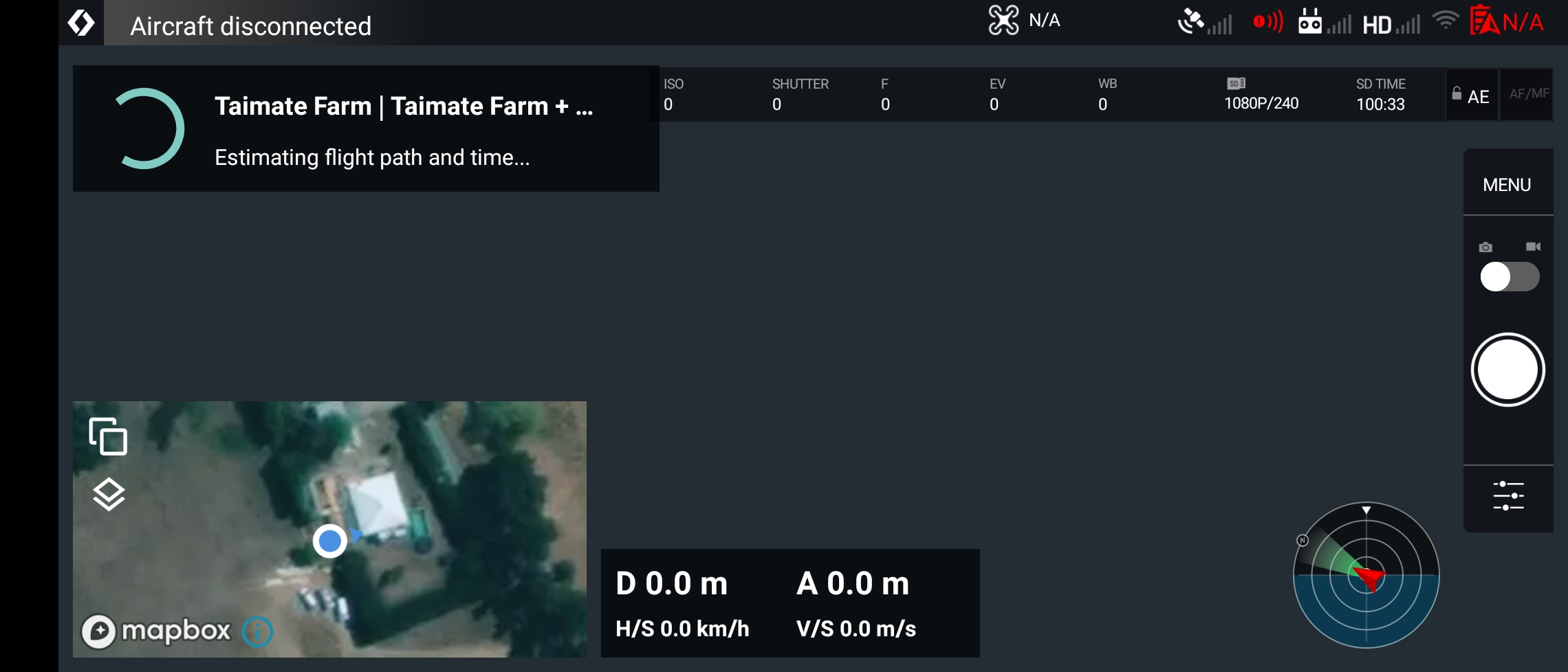
I have been trying to run this plan on my mini 2: https://app.dronelink.com/matthew-hickman/my-first-project/plan/RXKpReyLwrhx9iWLm0vI
when I try to run it the dronelink app will do its normal loading screen for 5 - 20 mins then the app closes I have tried it on both my note 10+ and a ipad pro
when I run other smaller maps like: https://app.dronelink.com/matthew-hickman/my-first-project/plan/1ZnJrlDmgZanTlpztnUD it works fine.
hope someone can help me, Thanks
Comments
4 comments
You need to split your map into much smaller segments (probably less than 100ac each). We are considering adding optimizations for larger missions, but even if we do, there is still a logistical issue of how to even fly such missions - in terms of where you take off from, maintaining VLOS, etc.
This is 2,000 acres. If you really need to map 2,000 acres then, as Jim said, you will need to split that into smaller chunks. I regularly do 400 acres, but I wouldn't do much more than that.
I was looking at a project last year that would have been 2,100 acres. We planned to do it using a P4P and split into a number of missions around 400 acres each for that very reason.
And, if you really need to map 2000 acres, might I suggest that the Mavic Mini 2 isn't the right tool for the job?
I realize this isn't the US, so maybe the VLOS rules don't apply. But you will be out of signal range very fast and, given that this only runs on virtual stick, the chances of you having success with any software using that drone on that size of property is slim at best.
Hi thanks for the advice
Those laws don't apply for me here as pre nz law it's all over private property.
Once I split it into smaller chunks I will move to a point near the approach point each time.
This might take me days of doing it bit buy bit but I will get it done
Thanks for the help, Matt
Setting aside legalities, there is practicality and safety to consider. Even if Dronelink did support missions this large, you still need to solve the issue of battery swaps, where you will fly from to maintain signal (which I assume would have to change over time), and how that affects the altitude (as it is measured from each take-off location). This map doesn't have AGL enabled, and even if it did, that assumes you are taking off from the same point. If you don't, Dronelink can update the AGL altitudes based on the MSL altitude from your mobile device's GPS (assuming you are using a device that has a GPS chip), but that is only so accurate. This scenario also assumes that you know how to safely resume to a point that is below your takeoff location, which might happen given that this is a mountainous area.
Bottom line, it is theoretically possible but it would take great care and diligence to pull it off.
Please sign in to leave a comment.