Panoramic photos with Dronelink
Hello, I have been recently using Litchi to take panoramic photos like this one through photogrammetry, but the software I use to stitch the images together doesn't work quite right when you import too many photos (Kolor Autopano). My question is, would it be possible to do similar work with Dronelink and export it as an image only? I'm not sure if I'm explaining myself correctly. Thank you, regards.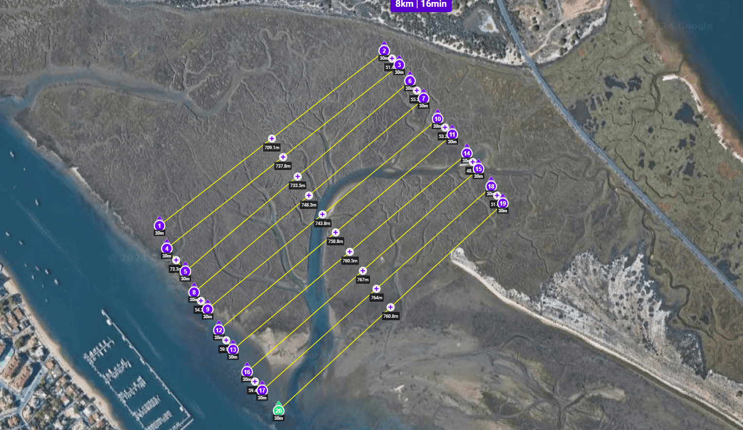
Comments
3 comments
All photo processing is done by the pilot with whatever software will work for their situation. Dronelink just captures the images but doesn’t do this whether a mapping, Panorana or 360 Photo component. WebODM is one software you can try but may many others out there.
Ok Mike, thank you very much.
Edu Amores
TBH - Litchi is a poor substitute for Dronelink, especially for mapping (photogrammetry), since you have to manually draw each path, including calculating how far apart the paths should be, how fast you can fly given the altitude and camera setup, etc.
The Dronelink mapping component will do all of that for you. All you need to do is draw the area and provide a few details such as overlap, altitude, maximum speed, etc. it will automatically calculate everything else for you. No manually drawing each line, If you know what Ground Sampling Distance you need (GSD) it will calculate that too.
I put a bunch of videos together in a playlist that should help you go from zero to hero quickly. Check that out here: https://www.youtube.com/playlist?list=PLK_joCFfIhJ84Uu5n6EML4VHDsSpjp4qs
Hope that helps!
You can then use
Please sign in to leave a comment.