Discrepancy between Mission Preview and Real Drone Shots
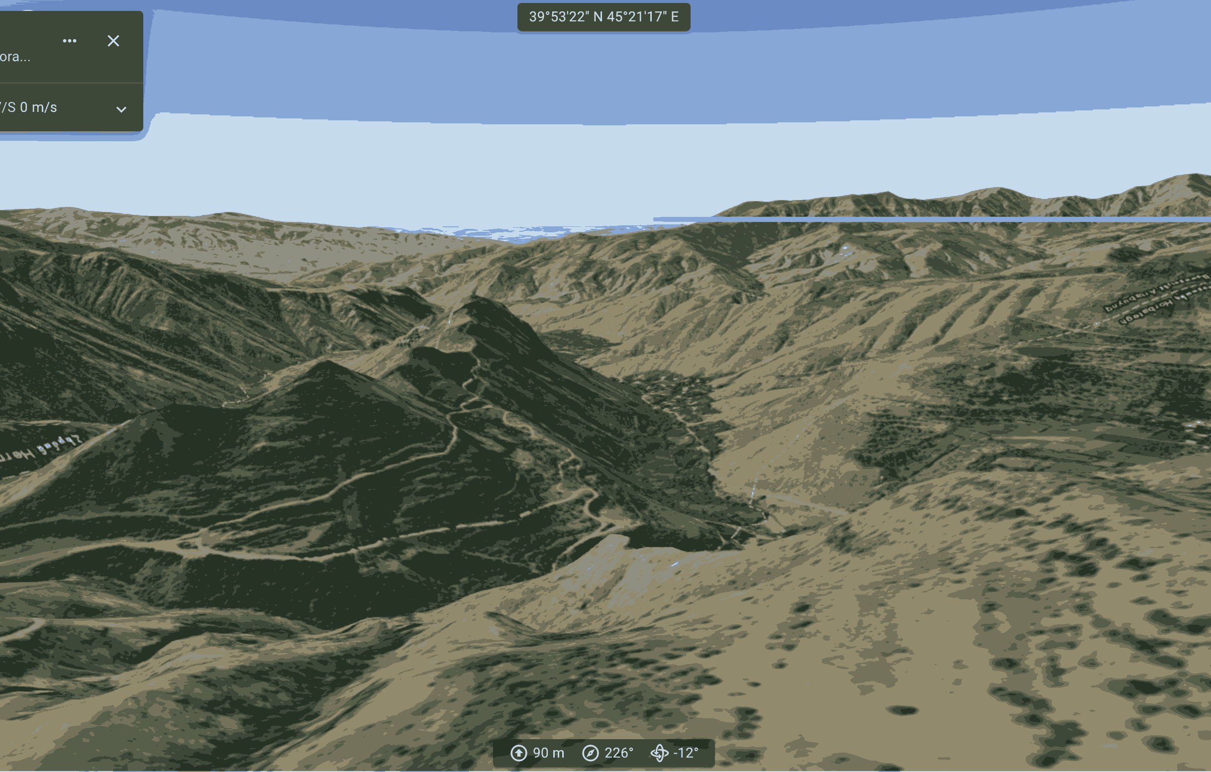
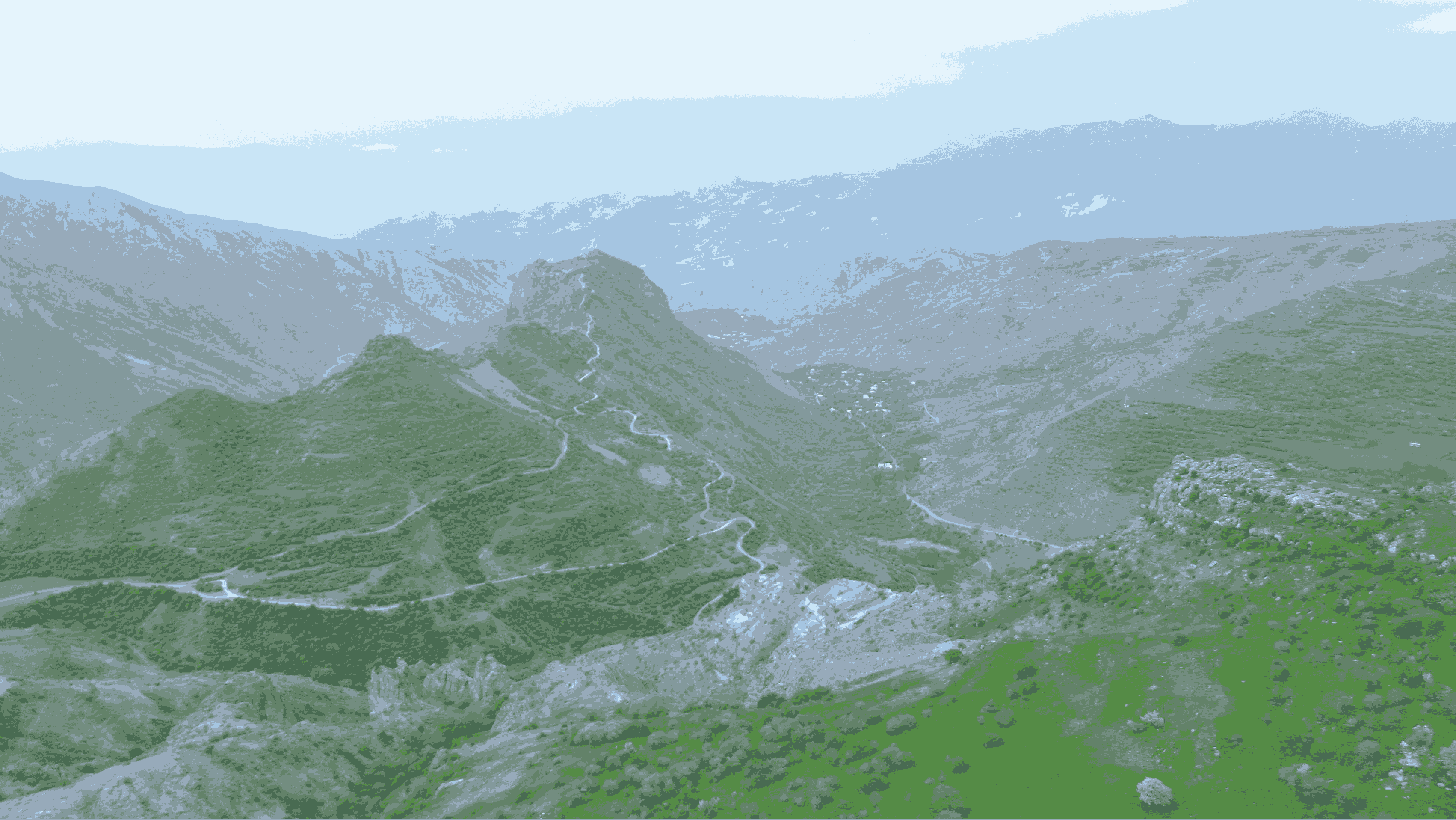
Dear experienced users, could you please advise me on where I went wrong? There is a significant difference between the Mission preview and real drone shots taken with the Mini 3 (I have attached the images). The real footage appears to have been captured from a closer distance and/or lower altitude. The camera is set up correctly in the Mission preview. Actual FOV is on. The only thing I suspect is that I completed another mission without returning home before starting this one. The starting point was the same in both plans, and I followed it closely. Is it possible that the DL application calculates the starting point and altitude of the mission based not on the initial takeoff point, but on the endpoint of the previous mission? Thank you for your help.
Comments
2 comments
A few things to consider.
1. Altitude is always from take off regardless of whether you started in the air. But altitude is calculated based on barometric pressure, so there is a small chance that the pressure changed enough to cause the altitude to shift after take off. That usually only happens when there is a significant change in the weather.
2. Accuracy is always going to be an approximation IMHO
3. Did you remember to select the correct drone before exporting to Google Earth?
Thank you, Barry!
Yes, the drone is set up correctly in the Mission preview.
Please sign in to leave a comment.