Terrain Follow can be enabled to fly a constant altitude above ground level (AGL) based on the ground elevation. Dronelink uses ESRI's World Elevation Services for this data.
A Starter or Growth plan are required for Terrain Follow. This feature is not included in Hobbyist plans.
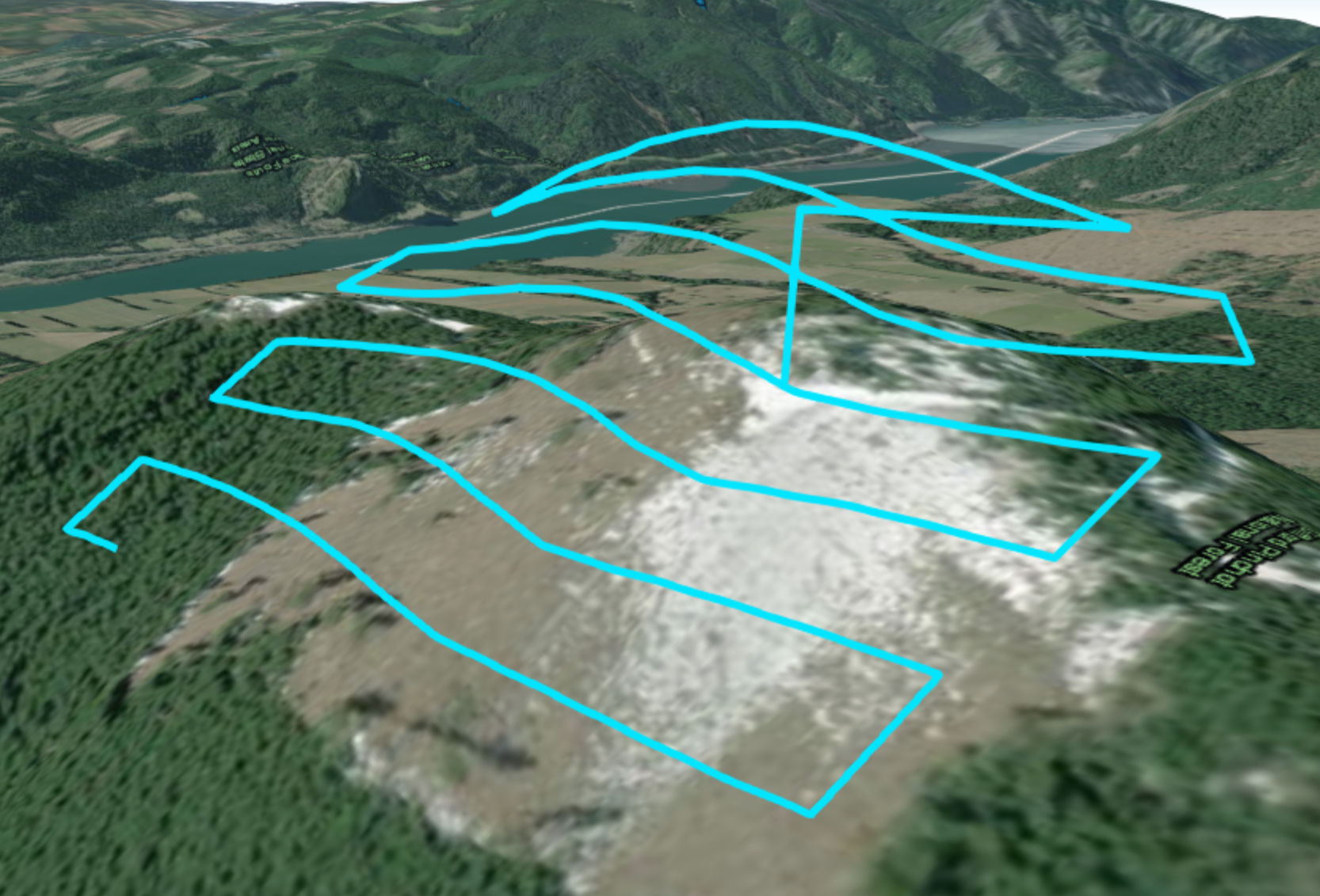
Always make sure to preview the flight in 3D before flying the mission to ensure safety. The drone may need to descend in altitude to reach the map starting point.
Enable Terrain Follow
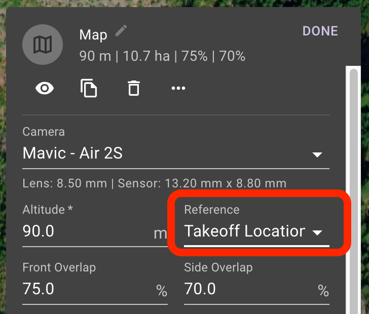
In the Advanced Map Settings, select the Reference dropdown next to the Altitude Setting.
Select Terrain Follow (AGL)
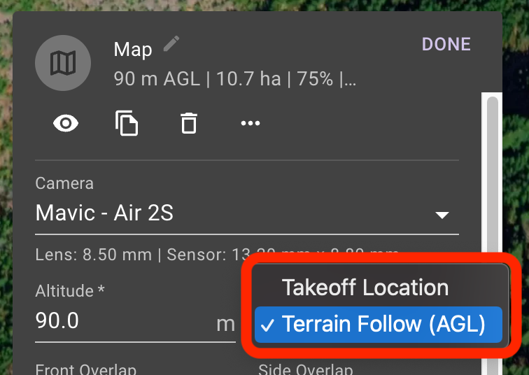
Once enabled, a message will display indicating that elevations have been updated.

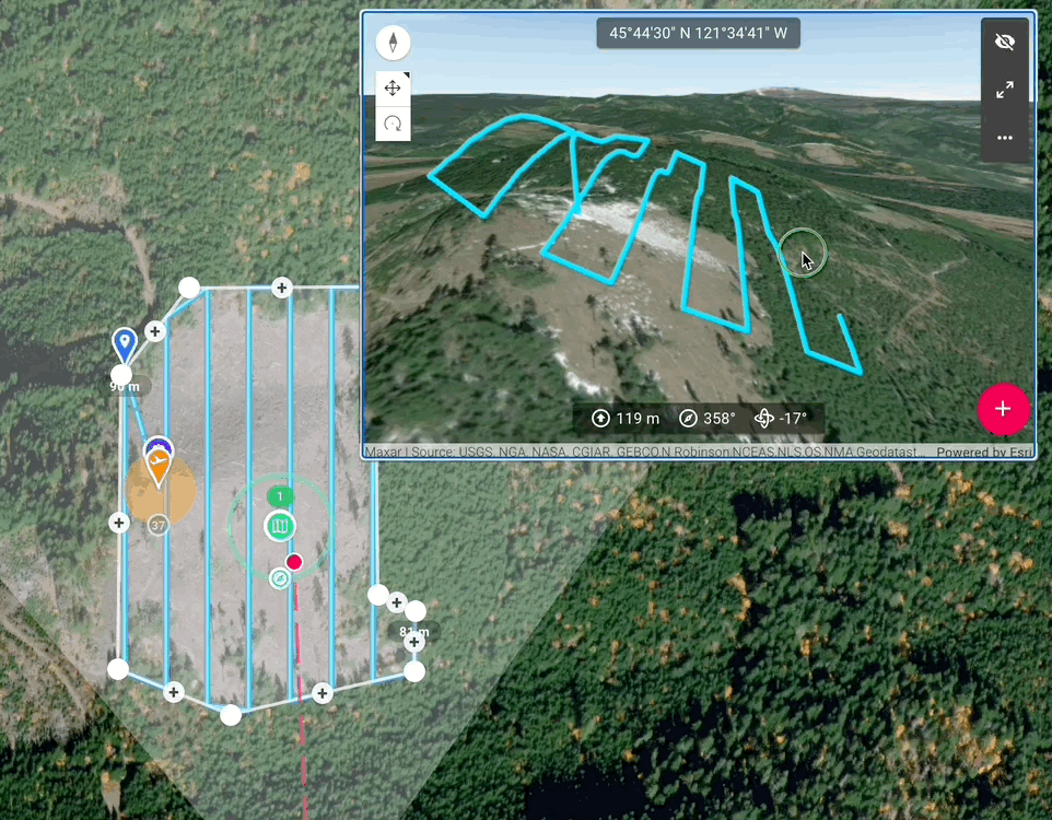
Preview the plan in 3D to see how the flight path follows the terrain. Export to Google Earth to check.
Takeoff Restriction
A take-off restriction will be automatically added to your mission plan. This is the yellow circle added at the mission reference point within which the drone will need to take-off.
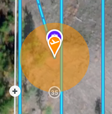
When using terrain follow, the take-off location is important as the entire mission plan altitudes have been determined based on the take-off location.
Drag the number to change the size of the take-off restriction zone.
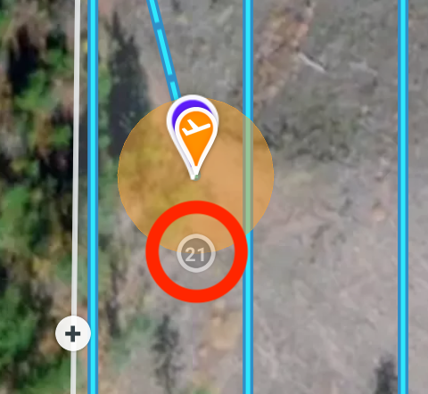
If you do not have a take-off restriction enabled, and have terrain follow enabled, you may risk a drone crash.